Paris Map
Map of Paris
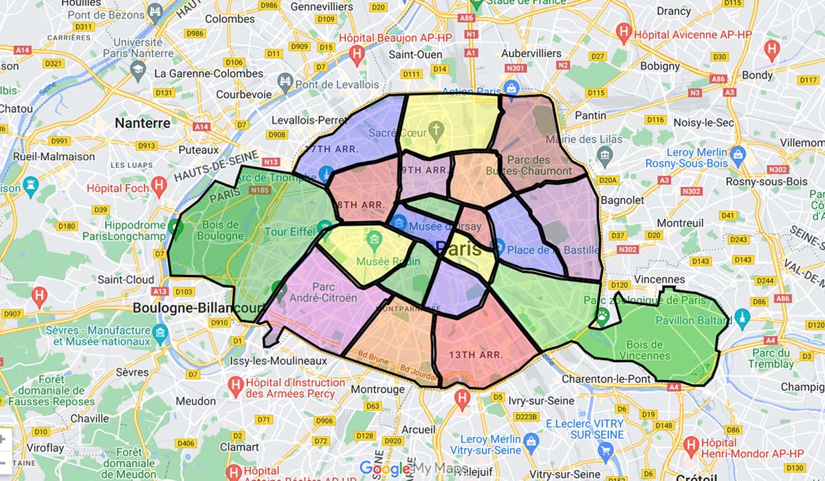
Do you need a Paris map? So here is a map of Paris that you can use either in a static or dynamic manner. Further down, you can also access the map of a specific arrondissement of Paris.

The Paris map here above is a static one. If you need to use a dynamic and interactive Paris map, feel free to use the following map with zooming and moving possibilities:
Paris map with arrondissements
You will see a particular district later? Here is the list of the 20 boroughs. By clicking on one of the links below, you will find a map of Paris centered on the arrondissement or Paris area of your choice, with its monuments, streets and avenues, shops – hotels, restaurants, etc.< /p>
Map of Paris by arrondissement
If you wish to directly access the Paris map of a particular arrondissement, click on the corresponding link below:
Paris Center and Rive Droite or Right Bank (1st – 4th)
Paris Rive Gauche or Left Bank (5th- 7th)
Paris Rive Droite (8th – 12th)
- Paris 8th arrondissement
- Paris 9th arrondissement
- Paris 10th arrondissement
- Paris 11th arrondissement
- Paris 12nd arrondissement
Paris Rive Gauche (13th – 15th)
Paris Rive Droite (16th – 20th)
- Paris 16th arrondissement
- Paris 17th arrondissement
- Paris 18th arrondissement
- Paris 19th arrondissement
- Paris 20th arrondissement
Presentation of the arrondissements
Looking at the Paris map, you can see that arrondissements of Paris are administrative divisions that partition Paris into twenty arrondissements which are all municipalities with their own administration. The arrondissements are comparable at the national level to cantons in French regions.
This division of the capital of France into arrondissements dates back to the year 1795. Paris then had twelve arrondissements. It was not until 1859 that their number rose to twenty with the annexation of the nearby suburbs. It was also at this time that spiral numbering was adopted, starting from the districts of central Paris to the peripheral districts. Among the municipalities annexed in the 19th century, we can notably cite Grenelle (15th), Vaugirard (15th), La Villette (19th) and Belleville (19th and 20th today). Many other villages could also be cited: Auteuil, Batignolles-Monceau, Belleville, Bercy, Charonne, Grenelle, La Villette, Montmartre, Vaugirard, etc.
Today each district of the capital has its own town hall for its administration, town hall usually located in a beautiful Haussmann building.
Each arrondissement has its own council, whose members are elected during municipal elections. This arrondissement council acts like a municipal council even if it does not have the same prerogatives.
A specificity of the city of Paris is that the first members elected on each electoral list are councilors of Paris, and as such also sit on the Council of Paris. The other elected members are arrondissement councillors, and can only sit on the arrondissement Council.
Peripheral arrondissements such as the 15th, 18th, 19th and 20th are the most populated in Paris. Conversely, the central arrondissements such as the 1st, 2nd, 3rd, 4th, 6th and 8th are those with the fewest inhabitants. This distribution closely follows the area of the arrondissements: the most populated are also those with the largest area.
Each district has its own postal code like any municipality in France. This postal code is made up of the numbers 75 followed by the three-digit arrondissement number: 001 for the 1st (75001) up to 020 for the 20th (75020).
See also: Paris metro metro stations
